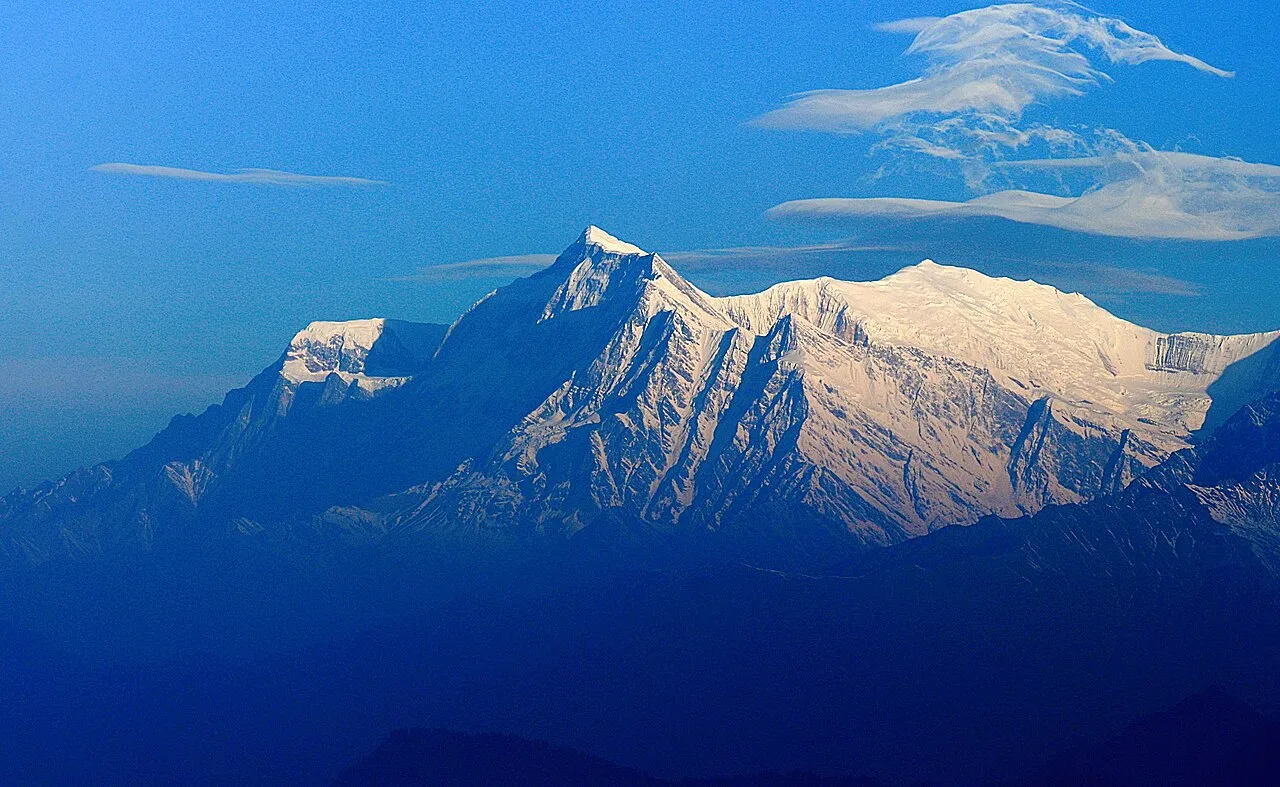
Gurja Khani sits at roughly 2,650 metres on the southern flank of Gurja Himal (7,193 m), between the mountain’s face and the Gurja Deorali pass. It is widely regarded as the largest and highest Chhantyal village in the Dhaulagiri region, and today falls within Dhaulagiri Rural Municipality of Myagdi. So hidden is it that the nearest village is described as a full day’s walk away over steep terrain.
Trace-back
Like so many of our settlements, Gurja Khani was born of the copper mines. It took shape during the mining era, when Chhantyal miners settled here alongside Bishwakarma metalworkers who processed the ore — the indigenous diggers and the metal-smiths bound together in a single craft. The very name ends in “-khani” — Nepali for “mine” — a permanent reminder of why our ancestors first climbed to this high shelf of the Himalaya. The Nepali Times records that the workings were finally given up under the burden of high taxes and the spread of cheap imported aluminium utensils that undercut the old copper trade.
What people do
With the mines long quiet, life now turns on subsistence farming and wage labour, with livestock grazed across the seasonal pastures and — like much of rural Nepal today — income sent home from family working away. Lying near the Gurja Himal and Dhorpatan trekking routes, the village also sees a slow trickle of tourism.
Faith and the mountain
The community keeps a deep reverence for nature and ancestor spirits, and shamanic practice still threads through village life. When an avalanche tore through a Korean expedition’s base camp beneath Gurja Himal in October 2018 — killing nine climbers, among them the celebrated Korean mountaineer Kim Chang-ho — villagers spoke of it, the Nepali Times reported, as the wrath of the mountain deity at humans defiling the heights.
At the time of the 1991 census
Gurja Khani recorded a population of 874 people living in 160 households — among the larger Chhantyal communities of Myagdi. More recently the Nepali Times described a settlement of around 260 households.
Have photos, memories, or up-to-date figures from Gurja Khani? Help us keep this story accurate through the Connect page.
Sources
Know this village? Help us complete and correct its story through the Connect page. ✏️ Suggest a correction to this page